Greenway Trails
Getting There & Parking
Features as You Walk
More Trails
Our 'You are Here' Map
Interpretive Information

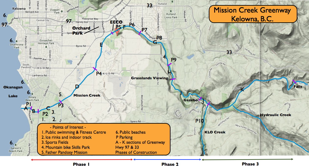
We begin describing features at the outfall of Mission Creek into Okanagan Lake, and travel upstream. Click on the section of the Greenway ( A to K) that you wish to view.
Each photo is designated by a letter/number which indicates the approximate location where the photo was taken.
Location's are lettered (A - K) on the simplified map at the bottom of this page. Most are the names of roads that cross the creek. Numbers indicate location within a letter, beginning downstream.

Visiting Phase 1 Red (the 8 km of the Greenway closest to Okanagan Lake). Sections A to F.
Visiting Phase 2 Blue (the Greenway 8 to 16 km from Okanagan Lake). Sections G to J.
Visiting Phase 3 Yellow/Green (under construction) Sections K and above.

